

Three Things To Know
- Heavy rain is possible Monday night into Tuesday morning, with repeated rounds of showers and thunderstorms.
- North-central Wisconsin has an enhanced flooding concern, with some forecast guidance supporting 2 to 4 inches of rain in the broader Minnesota-to-Wisconsin corridor.
- The exact heavy-rain axis remains uncertain, so relatively small changes in the storm track could significantly change rainfall totals in any one location.
A moisture-rich storm system moving across the Upper Midwest could bring several rounds of heavy rain to parts of Wisconsin Monday night into Tuesday morning, raising the risk of localized flooding.
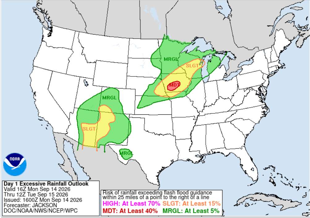
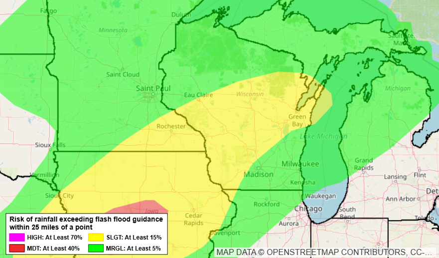
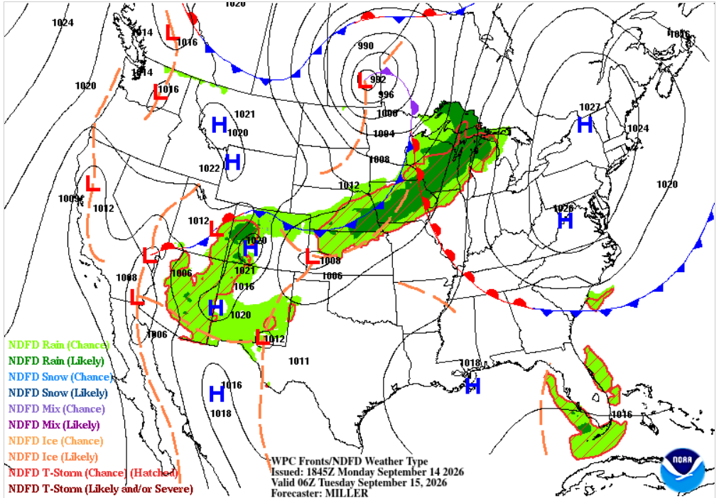
The Weather Prediction Center has highlighted parts of Wisconsin for excessive rainfall as a cold front slowly approaches the region. The greatest concern in Wisconsin is across north-central portions of the state, where thunderstorms may repeatedly move over some of the same areas.
Wisconsin Rainfall Risk Increasing
Atmospheric moisture will be unusually high for September.
The Weather Prediction Center said precipitable water values, a measure of the total amount of moisture available in the atmosphere, are expected to reach around 2 inches from Iowa into central Wisconsin Monday night. That’s roughly two to three standard deviations above normal.
With winds in the lower atmosphere running nearly parallel to the approaching cold front, showers and thunderstorms could repeatedly track across similar areas.
That setup can produce locally significant rainfall totals even if individual thunderstorms are not especially severe.
2 to 4 Inches Possible in Heaviest Rain Corridor
Updated high-resolution forecast guidance favors a swath of 2 to 4 inches of rain extending from southeastern Minnesota into north-central Wisconsin.
The Weather Prediction Center noted that newer computer models have increased the coverage of heavy rainfall across north-central Wisconsin Monday evening and overnight.
The region remains within a Slight Risk of excessive rainfall, but the Weather Prediction Center indicated the threat there has become more enhanced than earlier forecasts suggested.
Farther southwest, portions of central Iowa are under a Moderate Risk of excessive rainfall, where repeated thunderstorms could produce a more concentrated flooding threat.
Timing the Wisconsin Rain
For Wisconsin, the main period to watch will be Monday evening through early Tuesday morning.
Multiple rounds of showers and thunderstorms may develop ahead of the approaching cold front. Where storms repeatedly move across the same locations, rainfall totals could quickly add up.
The exact placement of the heaviest rain remains uncertain. One of the biggest forecast questions is how far east the heavier rainfall developing over Iowa will extend and how much additional thunderstorm development occurs ahead of the front overnight.
Track the storm on our Live Stream page.
Localized Flooding Is the Main Concern
Areas receiving repeated thunderstorms will have the greatest potential for flooding.
Heavy rainfall over a short period can overwhelm storm drains and lead to ponding on roads. Smaller streams and other flood-prone locations could also respond quickly if the higher rainfall totals materialize.
Drivers traveling Monday night or during the Tuesday morning commute should be prepared for areas of heavy rain, reduced visibility and water covering portions of roads.
Never drive through a flooded roadway. Water depth can be difficult to judge, particularly at night.
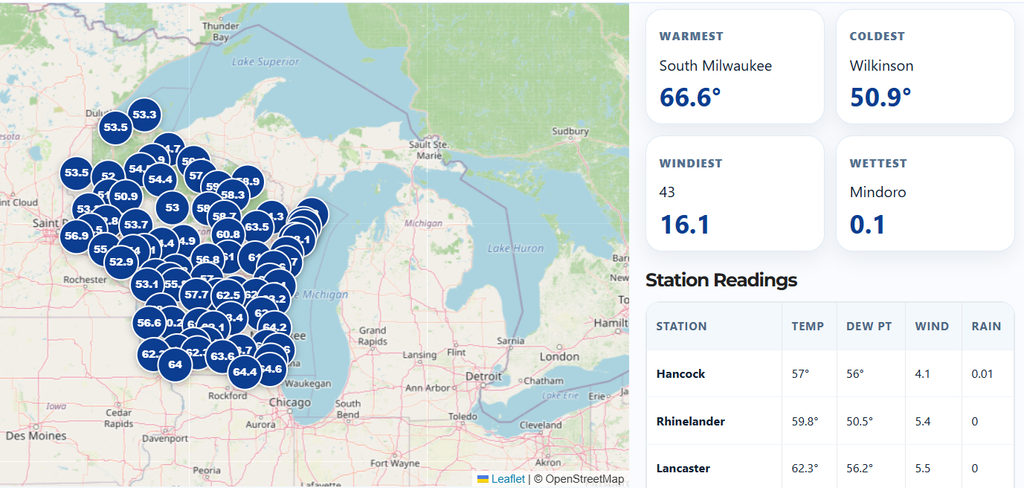
Track the rainfall totals on our Live Weather Conditions page.
What to Watch Tonight
The overall setup favors a corridor of heavy rainfall somewhere across the Upper Midwest, but relatively small shifts in where thunderstorms repeatedly develop could make a major difference in local totals.
For Wisconsin, north-central areas currently appear to have the greatest potential for several inches of rain. Other portions of the state could also see locally heavy rainfall as showers and thunderstorms move through.
Wisconsin Weather Now will continue to track the evolution of the storms and any flood watches or warnings that are issued.
