


When it comes to heavy rain and flooding Southern and Western Wisconsin are not out of the woods yet. After heavy rain soaked parts of the region, another round of showers and thunderstorms could produce locally heavy rainfall Saturday night into Sunday morning. Flood Watches remain in effect across a large portion of southern Wisconsin, while several rivers are now being monitored for possible flooding.
3 Things to Know
- More heavy rain is possible: Another round of showers and thunderstorms could bring moderate to heavy rain to southern Wisconsin Saturday night into Sunday morning.
- The ground is already saturated: Parts of southwest Wisconsin and surrounding areas have received 2 to more than 7 inches of rain during the past 24 hours, increasing the risk of runoff and flooding.
- Rivers are responding: Flood Watches have been issued for several rivers in southern Wisconsin, with some forecast to potentially reach flood stage Sunday.
The Weather Prediction Center continues to highlight parts of the Midwest for an elevated risk of excessive rainfall Saturday and Saturday night.
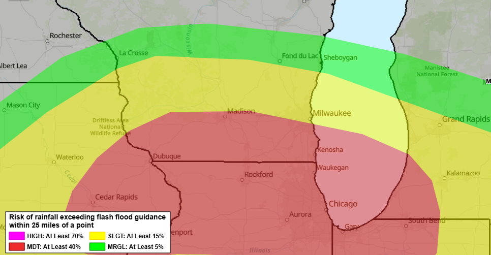
The greatest threat has shifted somewhat south into eastern Iowa, northern Illinois and northern Indiana, but southern Wisconsin remains close enough to the expected storm track for additional heavy rain to be a concern.
Heavy Rain Threat Continues
The Weather Prediction Center’s midday Saturday update maintains a Moderate Risk of excessive rainfall across parts of the Midwest, particularly eastern Iowa, northern Illinois and northern Indiana.
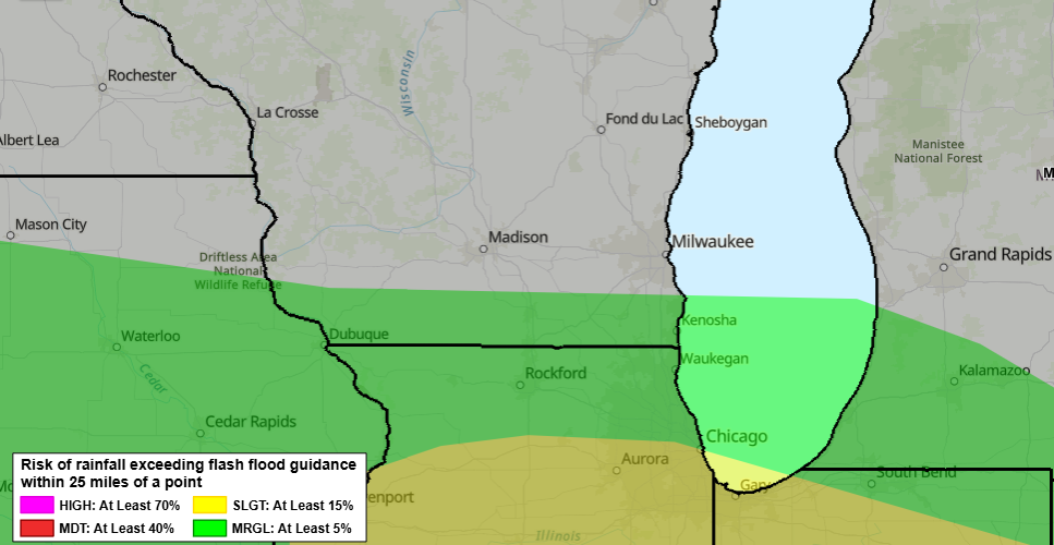
The latest high-resolution forecast models have shifted the axis of heaviest rainfall somewhat farther south. However, the WPC says there is still uncertainty over how far north the effective boundary will return Saturday night, leaving southern Wisconsin within the area of concern.
The atmosphere near and south of that boundary will be capable of supporting intense thunderstorms and high rainfall rates.
Some guidance suggests exceptionally heavy totals could develop within the broader Midwest storm corridor, with the experimental Rapid Refresh Forecast System showing moderate to high probabilities of more than 5 inches in portions of the region and lower probabilities of totals exceeding 8 inches.
Those extreme amounts are not specifically forecast for southern Wisconsin, but they illustrate how moisture-rich and efficient the atmosphere could become where repeated thunderstorms develop.
Flood Watch Through Sunday Morning
The National Weather Service in Milwaukee/Sullivan has extended a Flood Watch through Sunday morning for Dane, Green, Iowa, Jefferson, Kenosha, Lafayette, Milwaukee, Racine, Rock, Walworth and Waukesha counties.
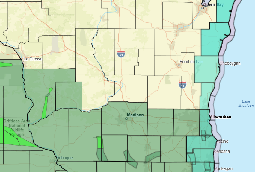
Moderate to heavy rain and thunderstorms are possible later Saturday night into Sunday morning. Excessive runoff could lead to flooding along rivers, creeks and streams as well as in low-lying and flood-prone locations.
Farther west, the situation is already more sensitive.
The National Weather Service in La Crosse reported that much of its Flood Watch area received 2 to more than 7 inches of rain during the previous 24 hours. Additional rainfall of up to 2 inches was possible through Saturday evening.
With that water continuing to work through area watersheds, additional rises along rivers and flooding of roads, parks and other low-lying locations are possible.
Rain Has Rivers Being Watched Closely
The National Weather Service has also issued Flood Watches for several rivers across southern Wisconsin.
Among them:
- Sugar River at Brodhead: Flood stage could be reached late Saturday night.
- Root River Canal at Raymond: Flood stage could be reached late Saturday night.
- Turtle Creek near Clinton: Flood stage could be reached late Saturday night.
- Pecatonica River at Martintown: Flood stage could be reached Sunday afternoon.
- Lower Fox River near New Munster: Flood stage could be reached Sunday afternoon.
- Root River at Franklin: Flood stage could be reached Sunday evening.
The river watches extend into different periods next week, with the Lower Fox River watch near New Munster continuing as late as Thursday evening.
That means the flooding concern may continue even after the rain ends. Water flowing downstream through saturated watersheds can keep rivers rising for hours or even days after the heaviest rainfall moves away.
Where the Forecast Gets Tricky
Exactly where the heaviest rain develops Saturday night remains uncertain.
Ongoing thunderstorms across the Midwest have helped push the most favorable environment farther south. The WPC noted that this could limit how far north the warm, moisture-rich air returns later Saturday.
If the boundary remains farther south, the most intense rainfall could focus primarily across Iowa, Illinois and Indiana. If it pushes farther north, southern Wisconsin could see a greater threat of repeated thunderstorms and locally heavy rainfall.
That boundary placement will be important to watch through Saturday evening. Watch our Forecast Page and Live Stream for updates.
Stay Alert Saturday Night
Anyone living near rivers, creeks or other flood-prone locations should monitor conditions closely through Sunday morning.
Flood Watches mean flooding is possible, not that it is occurring everywhere. If a Flood Warning is issued for your area, be prepared to act.
Never drive through a flooded roadway. Water can be deeper and faster-moving than it appears, and flooding can damage or completely wash away the road beneath the surface.
Even after the rain ends, continue monitoring river levels into early next week as runoff moves through southern Wisconsin’s rivers and streams.
