
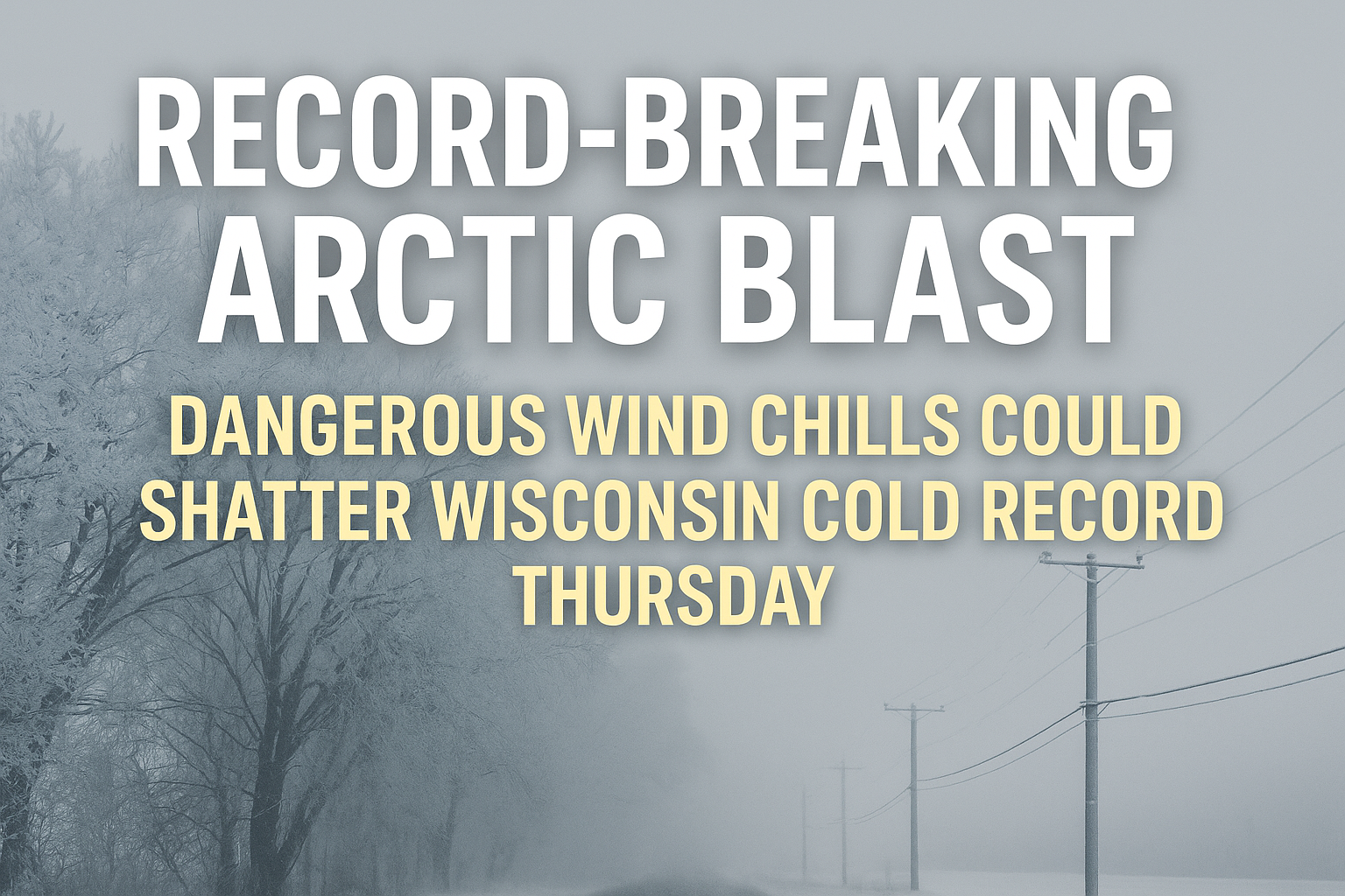
A powerful arctic blast hits Wisconsin Thursday with subzero wind chills and possible record-breaking cold lows. Here’s what to know and who gets the worst cold.
Wisconsin wakes up to a true punch of arctic air Thursday morning—one strong enough to challenge low-temperature records across portions of the Midwest and potentially here at home. While this week has already felt cold, the upcoming surge is in a different category.
“This is the kind of cold we usually see in mid-January, not the first week of December.”
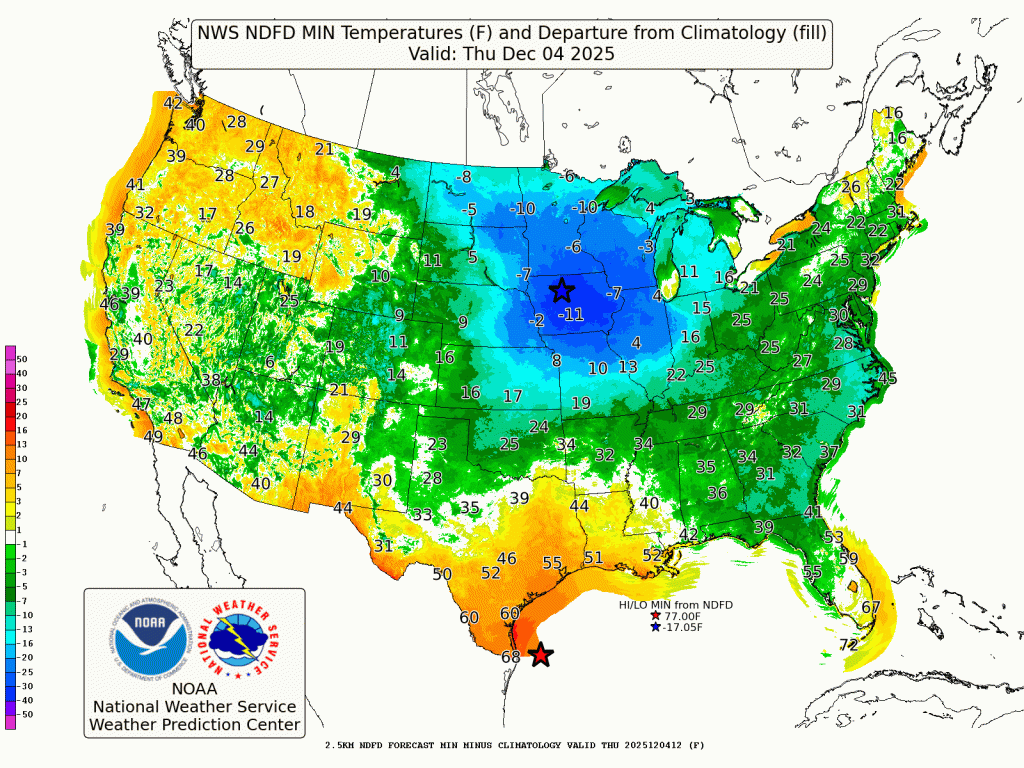
According to the National Weather Prediction Center, temperatures across the Upper Midwest may drop into the negative teens, especially across northern Wisconsin and the rural interior. Even southern parts of the state could see single digits or subzero lows by sunrise. Combined with brisk northwesterly winds, wind chills will easily dip into the -10 to -20° range.
Why Is This Cold So Intense?
This arctic air mass is unusually robust for early December. A broad upper trough over the central and eastern U.S. is creating a pipeline of repeated cold fronts, each reinforcing the chill.
For Wisconsin, that means:
- Rapid cooling late Wednesday night
- Wind chills bottoming out early Thursday
- A tough, slow warm-up during the day
With snow cover present in parts of the region, radiational cooling could also push temperatures even lower than forecast.

Wisconsin’s Microclimates: Not All Cold Is Equal
One of the most important—and most overlooked—details in extreme cold outbreaks is how differently various parts of Wisconsin respond.
“Rural and inland areas lose heat fast. The lake shore hangs onto warmth longer—but wind chills make up the difference.”
Key microclimate differences:
📍 Inland & Northwoods
- Coldest temperatures in the state
- Potential for -10° to -15° air temperatures
- Clear skies overnight = strong cooling
📍 Central Wisconsin
- Widespread single digits
- Subzero possible in low-lying rural areas
- Strong winds keep wind chills in dangerous territory
📍 Lake Michigan Shoreline
- Air temperatures not as low thanks to lake moderation
- But wind chills will still plunge due to steady northwest gusts
- A classic “feels colder than it is” setup
Could Records Fall?
Yes—especially in central and northern Wisconsin. Many daily records for December 4–5 are in the single digits below zero. Even if the air temperature doesn’t break records, wind chill values could set new early-December benchmarks.
What This Means for You
Even though this isn’t the coldest Wisconsin can get, the timing is unusual—and that’s what makes it so impactful. People aren’t acclimated yet, cars and furnaces haven’t been battle-tested, and early-season cold tends to catch many off guard.
Expect:
- Slower morning commutes
- Stiff wind chills through midday
- A day that never really “warms up”
If you’re headed out early, full winter gear is recommended—including hats and gloves.
Is This a Sign of the Winter Ahead?
It might be. Early-season arctic intrusions like this often coincide with more active, colder patterns in December. While long-range forecasting is complex, this type of early plunge fits with the broader pattern expected in a developing La Niña winter.
“If this is the opening act, winter is not going to be shy this year.”