
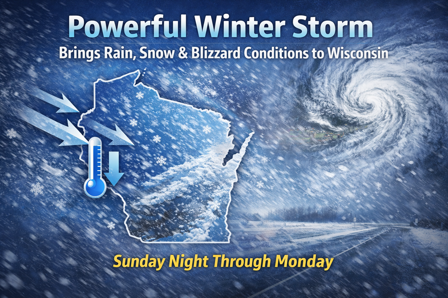
Rain will rapidly change to snow as a powerful winter storm brings strong winds, blowing snow, and dangerous travel conditions to Wisconsin Sunday into Monday.
Wisconsin is in the path of a powerful winter storm that will bring rapidly changing conditions from Sunday into Monday, including heavy snow, dangerous winds, and periods of near whiteout visibility.
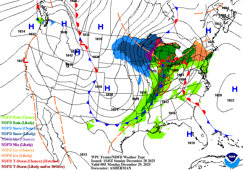
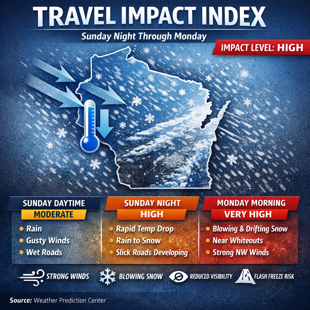
According to the Weather Prediction Center, an intense low pressure system strengthening along an arctic front will sweep across the Upper Midwest and Great Lakes, setting the stage for high-impact winter weather across the state.
“An intense cyclone will take the center stage with impacts from this system ranging from heavy snow and blizzard conditions across the upper Midwest to the Great Lakes,” the Weather Prediction Center said.
From Rain to Blizzard in Less Than 24 Hours
The storm will arrive in stages across Wisconsin. Rain and gusty winds will spread across much of the state Sunday, with embedded thunderstorms possible. As colder air surges in Sunday night, temperatures will fall rapidly below freezing, allowing rain to change to snow.
By early Monday, conditions are expected to deteriorate quickly as snowfall combines with strengthening northwest winds.
“Across the central Great Lakes, wind-swept rain and embedded thunderstorms later today into tonight are forecast to turn into a blizzard by early on Monday with blowing snow,” the Weather Prediction Center said.
This fast transition raises concerns for slick roads, rapidly changing visibility, and difficult travel conditions overnight.
Why This Storm Is So Strong
The strength of the system comes from a dramatic clash of air masses. Arctic air plunging south from Canada is colliding with unusually warm air that had dominated much of the central and southern United States.
The Weather Prediction Center noted the storm is “deriv[ing] energy from interacting with an outbreak of arctic air from Canada that is clashing with the anomalous warm air that has settled across the South for many days.”
This sharp temperature contrast allows the storm to intensify quickly as it moves through the Midwest.
Wind Is the Hidden Hazard
Snowfall totals alone will not tell the full story in Wisconsin. Strong and persistent winds will play a major role in impacts across the state.
Gusty northwest winds will create blowing and drifting snow, sharply reducing visibility even after the heaviest snow falls. In some areas, conditions may approach blizzard criteria despite snow totals that are not extreme by Wisconsin standards.
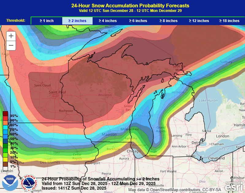
Blizzard Conditions Without Extreme Snow Totals
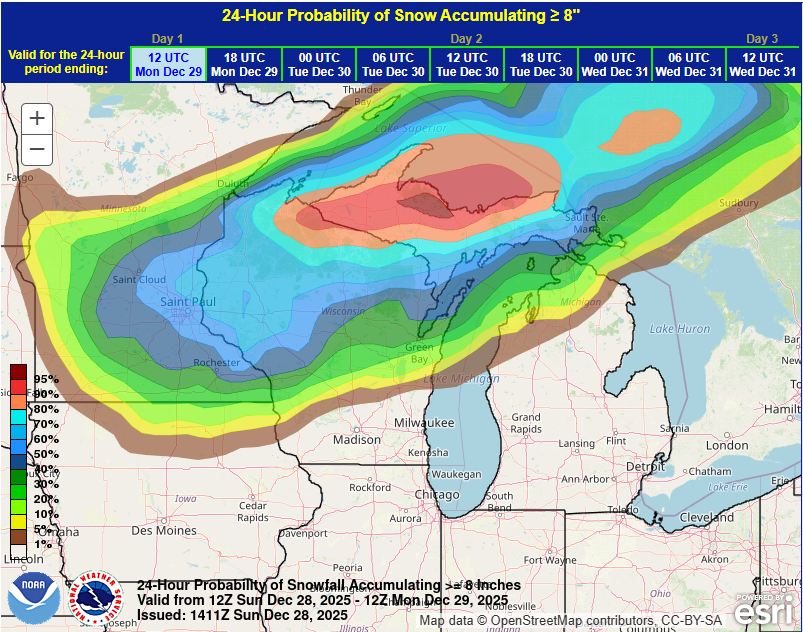
While the heaviest snow is expected farther north toward the Upper Great Lakes and Lake Superior, much of Wisconsin may experience hazardous conditions driven more by wind than by snowfall accumulation.
This means roads can become dangerous quickly, especially on open highways and rural routes where blowing snow can erase tire tracks within minutes.
Lake Effect Snow Lingers After the Storm
Even as the main storm system lifts into eastern Canada Monday, impacts will continue in Wisconsin. Cold air flowing over the Great Lakes will keep snow showers going in lake-favored areas, particularly downwind of Lake Michigan.
“The huge circulation of the system will continue to spread very strong and gusty winds into the entire eastern U.S. with snow lingering especially downwind from the lower Great Lakes,” the Weather Prediction Center said.
This lake effect snow could add additional accumulations and prolong slick travel into Monday night.
A Storm That Feels Bigger Than the Snow Map
The size of this storm matters. Its expansive circulation means strong winds, blowing snow, and cold air will linger well after the center of the system departs. That combination can extend impacts across Wisconsin even as snowfall tapers off.
The result is a classic high-impact winter setup where timing, wind, and temperature changes matter as much as snowfall totals.
Residents are urged to stay weather aware, monitor local forecasts, and prepare for rapidly changing conditions from Sunday through Monday as this potent winter storm moves through the state.