
Lake-effect snow ramps up across eastern Wisconsin through Monday. See which lakeshore communities could see the heaviest snow and travel impacts.
3 Things to Know
- Lake-enhanced snow transitions to lake-effect snow through Monday.
- Snow bands will be narrow and highly localized.
- Travel conditions may vary dramatically over short distances.
An upper-level storm system is sliding east, but for Wisconsin, the real story is just getting started. An upper-level low over the Great Lakes moves eastward out over the Atlantic by Saturday afternoon. As that system pulls away, colder air wrapping around it will keep snow going, especially near the lakes. For Northern Wisconsin and the Upper Penninsula, that means the lake-effect machine is turning on.
“The storm will produce lake-enhanced snow and then
-WPC
lake-effect snow over the Great Lakes through Monday.”
What This Means for Wisconsin
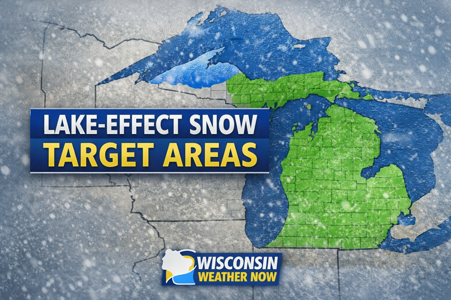
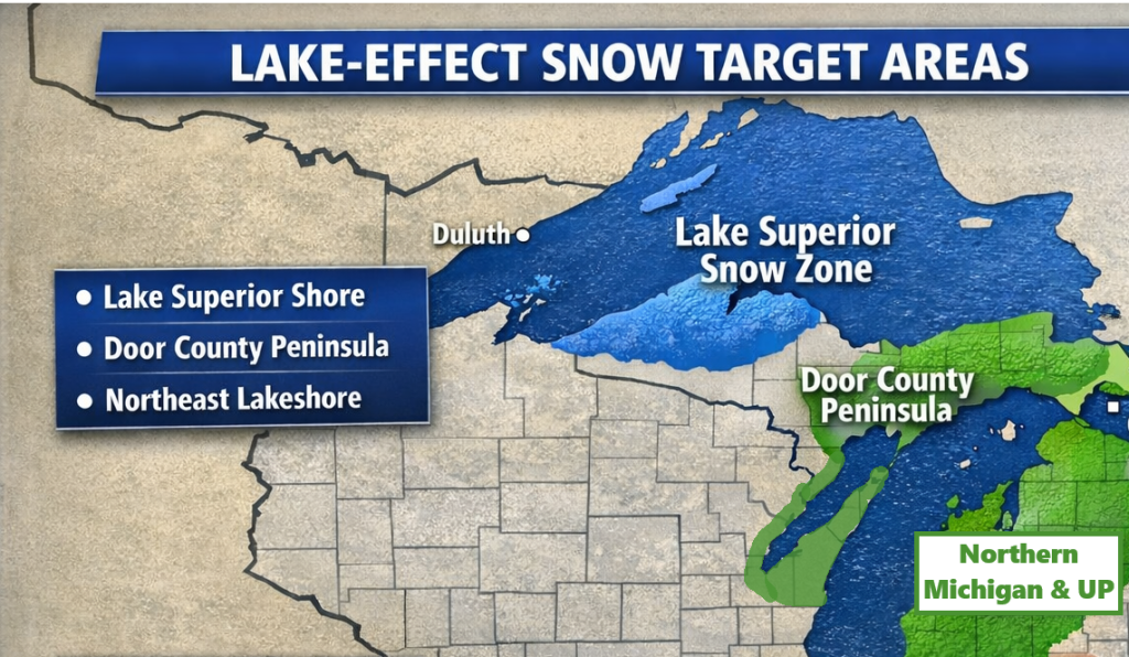
Lake-effect snow happens when cold air sweeps across relatively warmer lake waters, creating narrow but intense snow bands. Those bands can park over one community while another just a few miles away sees little accumulation.
Communities most favored in this setup typically include:
- Northeastern Wisconsin near Lake Michigan
- The Door Peninsula, including Door County
- Areas influenced by Lake Superior in far northern Wisconsin
Wind direction will determine who sees persistent bands versus off-and-on bursts. Even brief snow squalls could rapidly drop visibility and coat roads.
Timing the Impacts
Saturday: Transition from broader system snow to more localized lake-enhanced bands.
Saturday night into Sunday: Prime window for organized lake-effect bands.
Monday: Lingering snow showers gradually tapering but still capable of slick travel.
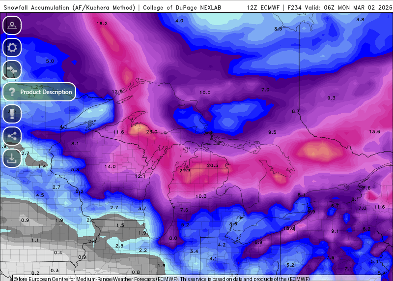
Because lake-effect snow is narrow and intense, totals can vary dramatically over short distances. Some neighborhoods may shovel multiple times, while others just deal with occasional bursts.
Why This Snow Setup Is Classic Upper Great Lakes Winter
This pattern is textbook:
- Large-scale low pressure exits.
- Colder northwest flow strengthens.
- Lakes fuel instability and narrow snow bands.
The broader storm may be gone, but the backside snow machine often produces the most persistent impacts for shoreline communities.
What to Watch
- Sudden whiteouts in snow squalls
- Rapid road deterioration
- Highly localized accumulation differences
- Gusty winds creating blowing snow
If you’re traveling along the lakeshore this weekend, conditions could change quickly, especially in banded snow. Keep an eye on our maps and forecast page for updates.
Lake-effect events don’t always produce blockbuster regional totals, but they do create some of the most disruptive, hyper-local winter weather in Wisconsin.