

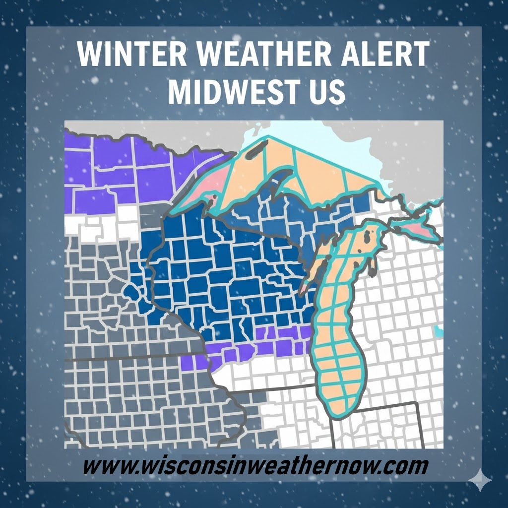
- Rain flips to snow Sunday night: A rapidly developing system brings 2–4 inches for advisory areas and 4–7 inches possible where Winter Storm Watches are posted, with a flash-freeze risk as temperatures drop quickly.
- Wind drives impacts: 40–50 mph gusts will cause blowing and drifting snow, reduced visibility, and slick roads, especially late Sunday night into Monday morning’s commute.
- Higher impacts north and along Lake Michigan: Central, northeast, and lakeshore counties including Door, Kewaunee, and Manitowoc face the greatest risk for difficult travel and spotty power outages.
A fast-developing winter system will sweep across Wisconsin late Sunday and Monday, bringing a quick change from rain to snow, falling temperatures, and strong winds. Multiple advisories and winter storm watches are in effect across the state, with travel impacts likely for the Monday morning commute.
Pull Quote: “A rapidly developing winter storm will bring snow and strong winds to the region from Sunday afternoon through Monday morning.”
National Weather Service La Crosse
What is happening with this storm
Milder air and rain on Sunday will give way to much colder air Sunday evening and overnight. As temperatures drop below freezing, rain will change to snow from west to east. Gusty northwest winds will increase overnight and Monday, leading to areas of blowing and drifting snow.
Several National Weather Service offices are highlighting the potential for a flash freeze, especially Sunday evening, when roads may still be wet as temperatures fall quickly.
“A flash freeze is also possible due to rapidly falling temperatures and wet roadways.”
National Weather Service La Crosse
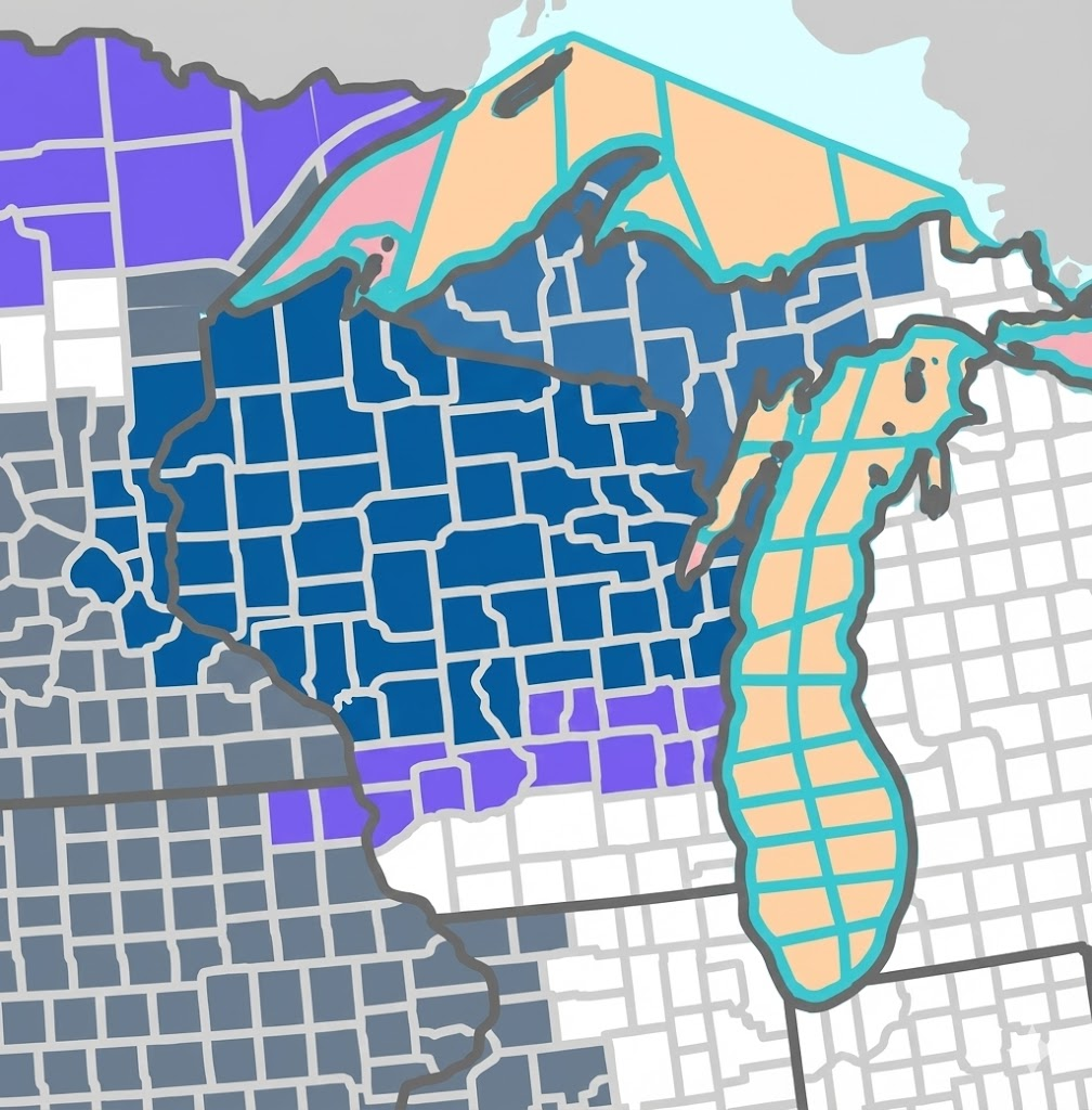
Winter Weather Advisory counties
Timing: 9 p.m. Sunday to noon Monday in most areas
Snow totals: Generally 2 to 4 inches
Wind: Gusts up to 40 to 45 mph
Advisories cover portions of east central, south central, and southeast Wisconsin, including counties such as Sauk, Columbia, Dodge, Washington, Ozaukee, Fond du Lac, Sheboygan, Green Lake, Marquette, Crawford, Richland, and Vernon. Slippery roads and reduced visibility are expected, especially late Sunday night into Monday morning.
“Plan on slippery road conditions. The hazardous conditions could impact the Monday morning commute.”
National Weather Service Milwaukee Sullivan
Winter Storm Watch areas
Timing: Sunday afternoon or evening through Monday morning or afternoon, depending on location
Snow totals: 4 to 7 inches possible
Wind: Gusts 40 to 50 mph with blowing and drifting snow
Winter Storm Watches stretch across central, north central, northeast, and lakeshore Wisconsin. This includes counties such as Adams, Juneau, Monroe, La Crosse, Jackson, Clark, Taylor, Buffalo, Trempealeau, Marathon, Wood, Portage, Brown, Outagamie, Winnebago, Calumet, Shawano, Waupaca, Waushara, Oconto, Marinette, and the lakeshore counties of Door, Kewaunee, and Manitowoc.
Door County stands out as one of the higher impact areas, where stronger winds could lead to power outages and tree damage.
“The combination of heavy snow and strong winds will likely result in some tree damage and power outages, especially in Door County.”
National Weather Service Green Bay

Travel and safety concerns
Motorists should be prepared for rapidly changing conditions late Sunday and overnight. Blowing snow may sharply reduce visibility at times, even where snowfall totals are lower. Bridges and overpasses are especially vulnerable to icing during a flash freeze.
Residents are encouraged to monitor forecast updates and consider adjusting travel plans if possible.
Lake Michigan storm hazards
While not county based, conditions on Lake Michigan will deteriorate quickly. Small Craft Advisories are in effect this weekend, with Gale Watches posted for Sunday night through Monday. Northwest gales and freezing spray are possible, making conditions dangerous for mariners.
“Very strong winds will cause hazardous waves which could capsize or damage vessels.”
National Weather Service Milwaukee Sullivan
Bottom line
Sunday starts wet and mild, but winter returns quickly Sunday night. Snow, strong winds, and falling temperatures will combine to make travel difficult in many parts of Wisconsin, with the highest impacts expected overnight into Monday morning. Stay weather aware and check local forecasts frequently as this system evolves.

“You get it. Rare to see someone articulate this stuff so directly and clearly”