
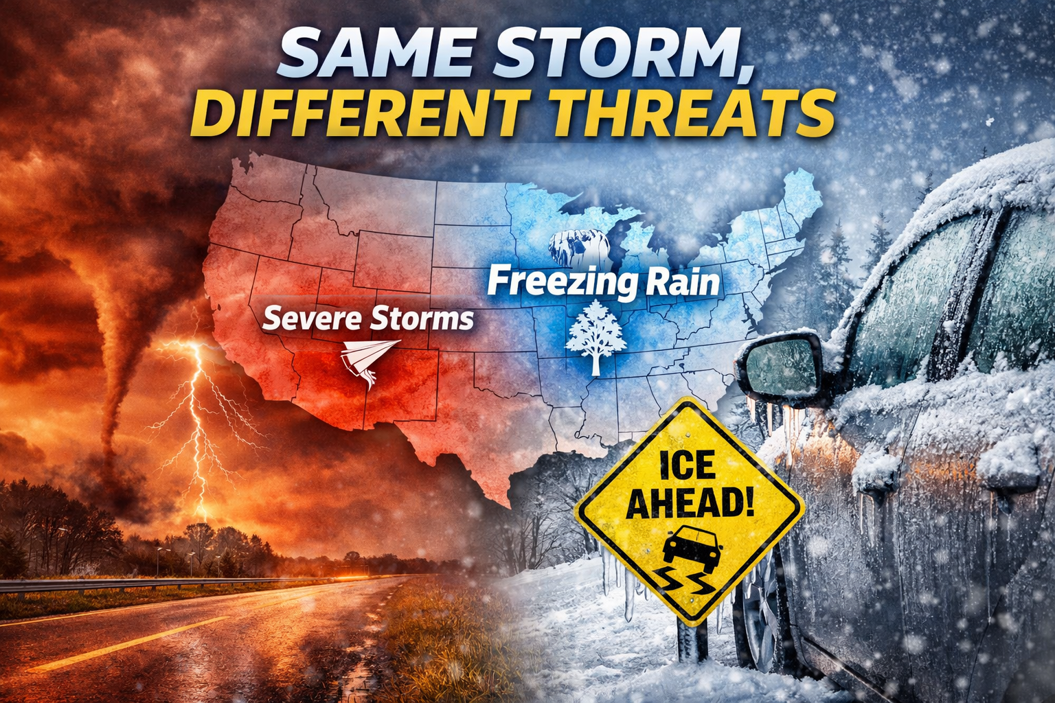
A powerful storm brings severe weather to the South while Wisconsin faces freezing rain and slick travel. Here’s what to know heading into the weekend.
The Least You Need To Know:
- Freezing rain possible late Thursday night into Friday, creating slick roads and sidewalks across parts of Wisconsin.
- The same storm system producing severe weather in the South will bring wintry impacts to the Upper Midwest instead.
- Another front late Friday into Saturday may bring light to moderate snow, adding to weekend travel concerns.
A powerful winter storm system is sweeping across the central and eastern United States, producing very different impacts depending on where you live. While parts of the Lower Mississippi and Tennessee valleys brace for severe thunderstorms, Wisconsin’s main concern is freezing rain, slick travel, and changing road conditions as the system moves through late Thursday night into Friday.
It’s a classic winter setup — and a reminder that the same storm can behave very differently across the country.

Why Wisconsin Isn’t the Severe Weather Story
Farther south, warm, moist air from the Gulf of Mexico is fueling thunderstorms capable of damaging winds, hail, and even tornadoes. That severe threat stays well south of Wisconsin.
Here in the Upper Midwest, colder air near the surface changes the equation. Instead of thunderstorms, precipitation may fall as rain or freezing rain, especially during the overnight and morning hours Friday. Even light ice can create outsized impacts on travel, sidewalks, and untreated roads.
“An area of rain/freezing rain will develop over parts of the Upper Mississippi Valley and the Upper Great Lakes,” according to the Weather Prediction Center.
That line sums up Wisconsin’s role in this storm perfectly: not the most dramatic weather on the national map, but potentially the most disruptive locally.
What This Means for Travel in Wisconsin
For drivers, timing matters more than totals.
- Thursday night into Friday morning: Greatest risk for slick roads if temperatures hover near or below freezing.
- Friday daytime: Conditions may improve in spots if temperatures rise, but lingering slick areas remain possible.
- Friday night into Saturday: Another cold front could bring light to moderate snow, especially north and east.
Because freezing rain can develop quickly and unevenly, travel conditions may vary significantly over short distances — a key reason winter icing events are so challenging.
One Storm, Two Stories
This system is a great example of how latitude and temperature profiles shape impacts:
- South: Warm air + moisture = severe thunderstorms and flooding concerns.
- Wisconsin: Shallow cold air near the surface = freezing rain, ice, and winter travel hazards.
Understanding that contrast helps explain why Wisconsin may not be in the national severe weather headlines — but still needs to stay weather-aware.
The Bottom Line
Wisconsin’s biggest risk from this storm isn’t thunder or tornadoes — it’s ice and changing road conditions, especially late Thursday night into Friday. As always with freezing rain setups, small temperature shifts will make a big difference, so forecast updates will be critical heading into the weekend.
Stay tuned for travel updates and local timing as the system moves through the Great Lakes.