

A dangerous severe weather setup is unfolding across the Midwest with tornadoes and giant hail possible in Illinois and Missouri. Here is what it could mean for Wisconsin tonight.
3 Things to Know
- A dangerous severe weather setup is expected south of Wisconsin with tornadoes and very large hail possible.
- Some storms in Illinois and Missouri could produce strong tornadoes rated EF2 or higher.
- If storms reach Wisconsin later tonight, the main threat would likely be hail and lightning rather than tornadoes.
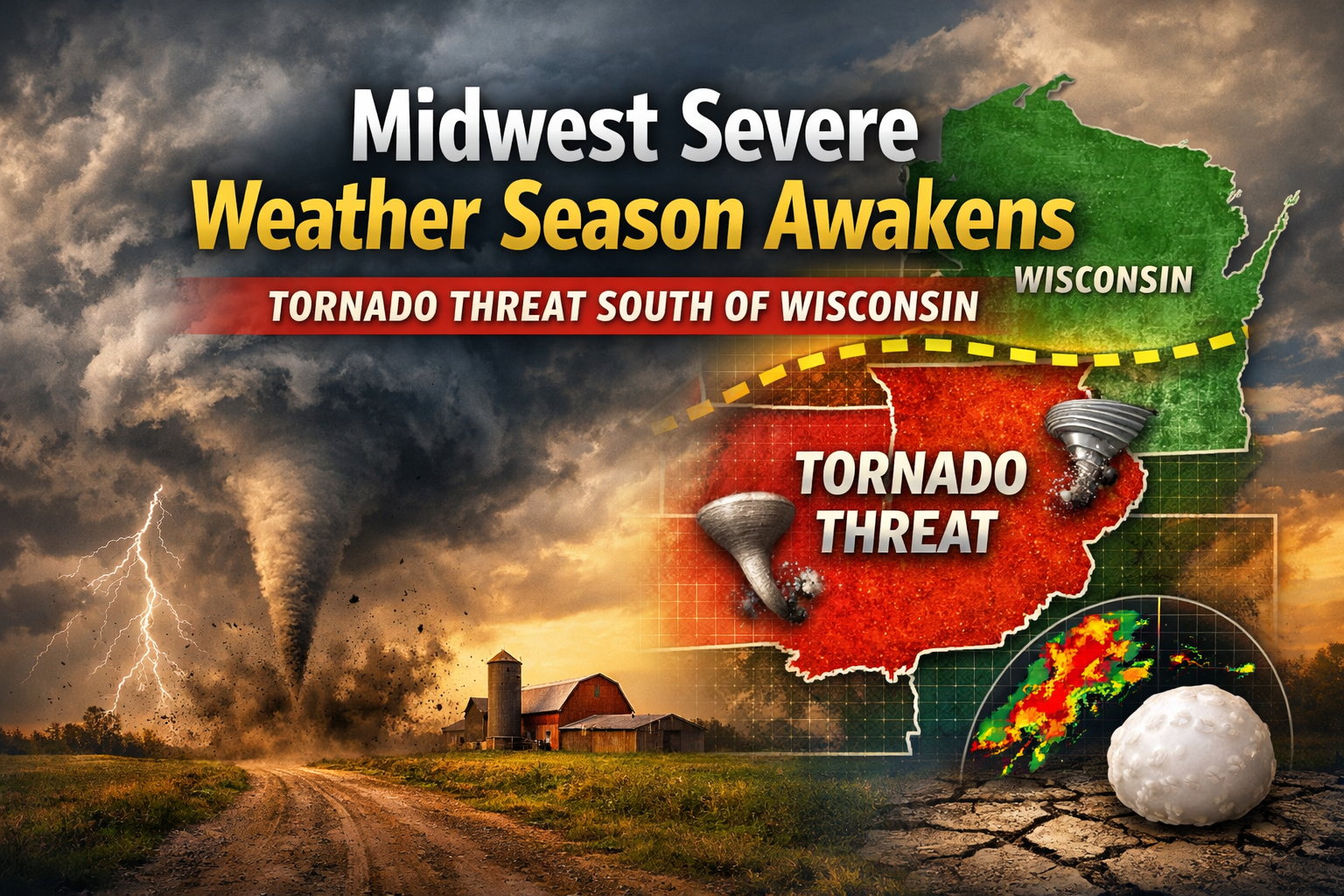
Midwest Severe Weather Season Awakens With Tornado Threat South of Wisconsin
A volatile severe weather setup is developing across parts of the Midwest Tuesday afternoon, signaling the first major tornado-producing storm environment of the season. Forecasters say storms forming from northeastern Missouri into Illinois could become intense supercells capable of producing tornadoes, very large hail and damaging winds.
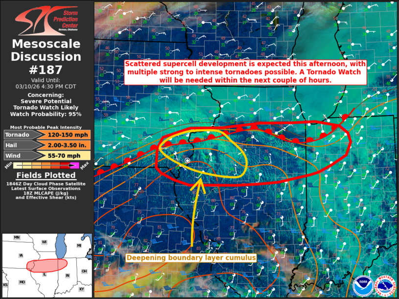
The Storm Prediction Center warns that the environment developing south of Wisconsin is highly favorable for severe thunderstorms. According to the SPC mesoscale discussion, the atmosphere is becoming increasingly unstable with moisture and wind shear combining to create conditions supportive of powerful storms.
Moderate to strong instability (1500 to 2500 J/kg MLCAPE), steep mid level lapse rates and strong effective bulk shear 50+ knots will support a very favorable environment for intense supercells capable of all severe hazards – SPC
The same discussion notes that hail larger than two inches in diameter could develop early in the storm cycle.
“Very large hail of 2+ inches in diameter will be possible initially,” forecasters said.
Tornado Threat Focused South of Wisconsin
The greatest concern lies along and just south of a surface warm front stretching across parts of Missouri and Illinois. As a strengthening low level jet develops this evening, the threat could increase significantly.
“The resultant enlarged and curved low level hodographs will support intense low level mesocyclones with supercells and an increasing risk for tornadoes,”
– SPC
“The resultant enlarged and curved low level hodographs will support intense low level mesocyclones with supercells and an increasing risk for tornadoes,” the Storm Prediction Center said.
Some storms could become strong or intense if storms remain isolated along the boundary.
The SPC added that storms along the warm front could produce “multiple strong to intense tornadoes (EF2-3+).”
What This Means for Wisconsin
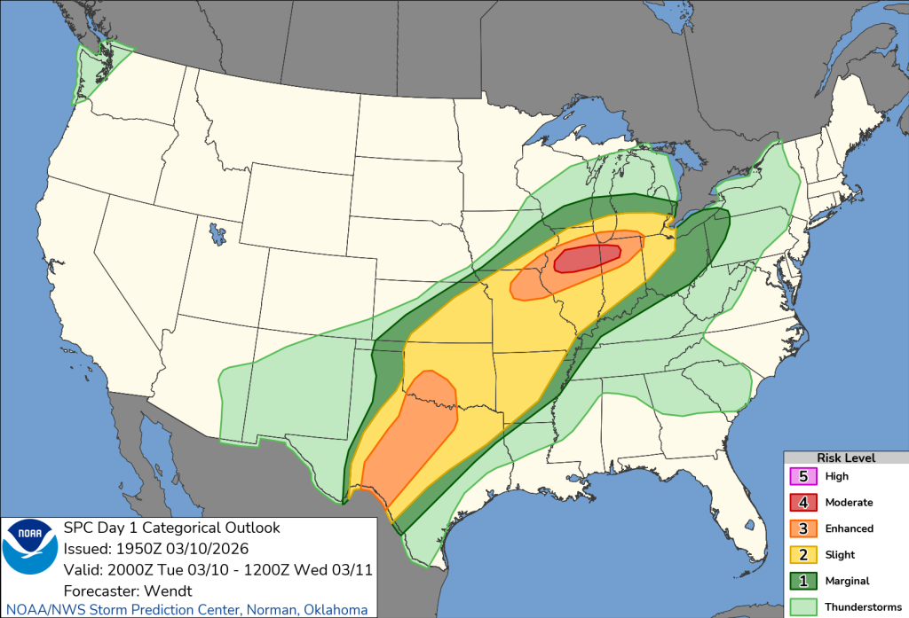
While the most dangerous storms are expected to remain south of the Wisconsin border, the setup is still worth watching closely. Wisconsin may remain north of the warm front through much of the evening, which typically limits tornado potential but can still allow strong storms to develop.
If storms move into southern Wisconsin later tonight, they would likely be elevated above the cooler surface air. In that scenario, the main risk would shift toward hail and lightning rather than tornadoes.
Storm development timing remains somewhat uncertain, but forecasters say thunderstorms could begin forming during the afternoon and intensify into the evening across Illinois and Missouri.
“The timing of convective initiation remains a bit uncertain,” the Storm Prediction Center said.
Regardless of the exact timing, the environment south of Wisconsin clearly signals that the Midwest severe weather season is beginning to ramp up.
