

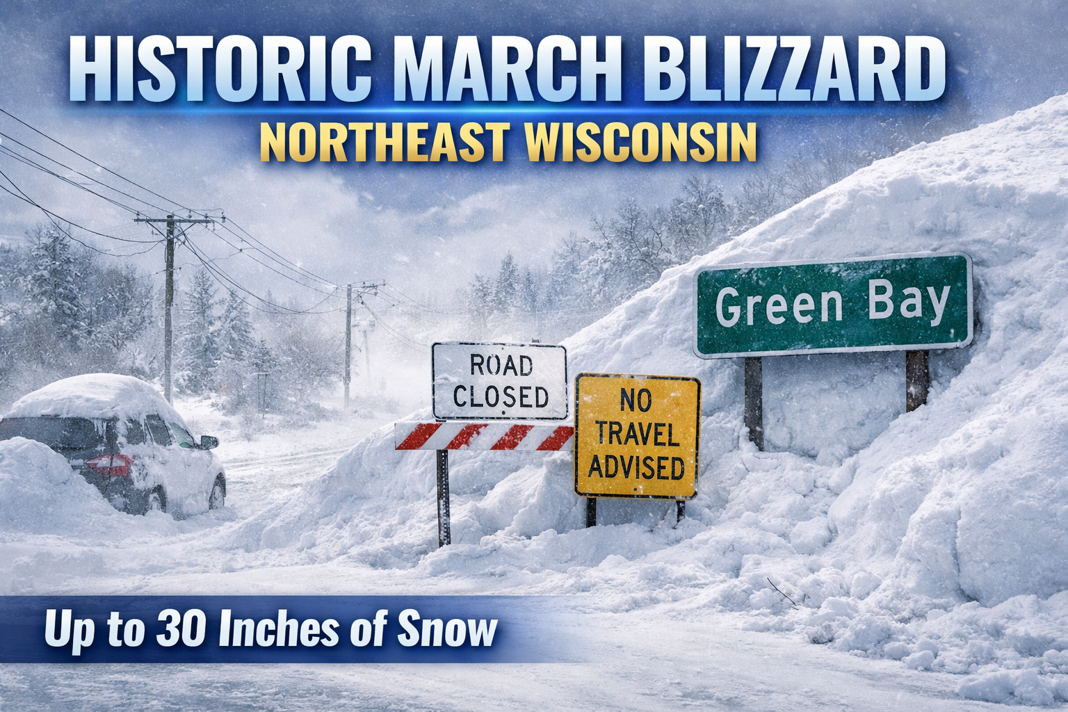
A historic March 14 to 16, 2026 winter storm dumped up to 30 inches of snow across northeast Wisconsin, causing blizzard conditions and widespread impacts.
Three things to know
- Historic snowfall of 1 to 2 feet, with more than 30 inches in some areas
- Blizzard conditions with wind gusts up to 60 mph and whiteout visibility
- Major impacts including travel shutdowns, power outages, and structural damage
Historic March storm slams northeast Wisconsin
A historic, record-setting winter storm brought crippling snow, ice, and wind to northeast Wisconsin from Saturday evening, March 14 through Monday evening, March 16. A powerful Colorado low tracked from the central Plains into the Great Lakes, producing a long duration of heavy precipitation across the region.
The storm began as snow Saturday evening before transitioning to a wintry mix of snow, sleet, and freezing rain early Sunday morning. Light ice accumulations developed across east-central Wisconsin before the system changed back to all snow by Sunday afternoon.
Heavy snow and thunder snow intensified Sunday
The most intense phase of the storm developed early Sunday, when snowfall rates reached as high as 4 inches per hour across central Wisconsin. Reports of thundersnow and thundersleet highlighted the strength of the system.
By midday Sunday, the heaviest snow shifted into northeast Wisconsin. Increasing northeast winds gusting between 35 and 50 mph led to near-blizzard conditions. Visibility dropped significantly as heavy snow combined with blowing and drifting.
Blizzard conditions returned Sunday night into Monday
After a brief lull Sunday evening, a second round of heavy snow redeveloped early Monday morning. Snowfall rates of 1 to 3 inches per hour spread across the Fox Valley and lakeshore.
Strong north winds gusting between 40 and 55 mph brought a return to blizzard conditions. Visibility frequently dropped to a quarter mile or less, creating whiteout conditions that made travel nearly impossible.
Historic snowfall totals across the region
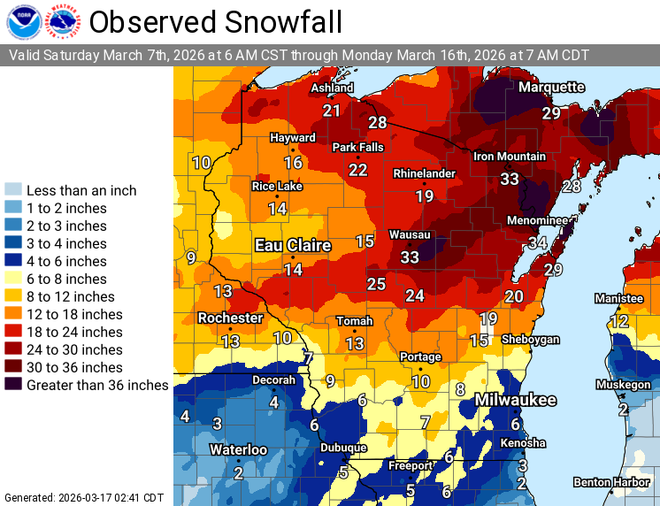
Final snowfall totals reached historic levels across northeast Wisconsin. Most areas received between 1 and 2 feet of snow, with localized totals exceeding 30 inches from Wausau to Marinette and Door County.
Green Bay recorded 26.6 inches of snow, making it the second-largest snowstorm on record for the city.
Widespread blizzard impacts and long recovery
The storm caused widespread and severe impacts across the region. Travel became nearly impossible for extended periods, with “No Travel Advised” conditions issued by the Wisconsin Department of Transportation. Tow bans were implemented and some communities suspended plowing operations.
Massive snowdrifts, including reports of drifts up to 10 feet in Ephraim, blocked roads and stranded vehicles. Power outages were widespread, especially in Door and Marinette counties. Structural damage was also reported, including building collapses in Sturgeon Bay and Kewaunee County.
Schools, businesses, and public services remained closed into Monday as cleanup and recovery efforts began.
This storm will stand as one of the most significant March winter events in northeast Wisconsin history due to its intensity, duration, and widespread impacts.
SNOW TOTALS BY COUNTY:
Brown County
Suamico – 27.5″
Ashwaubenon – 26.1″
New Franken – 26.0″
Green Bay – 24.0″
Denmark – 22.6″
Wrightstown – 20.8″
Greenleaf – 17.0″
Calumet County
Darboy – 18.0″
Brillion – 17.8″
Door County
Egg Harbor – 33.0″
Ephraim – 30.0″
Fish Creek – 28.5″
Forestville – 28.0″
Ellison Bay – 21.0″
Florence County
Florence – 21.3″
Manitowoc County
Mishicot – 16.0″
Two Rivers – 15.0″
Marathon County
Nutterville – 31.5″
Wausau – 30.9″
Brokaw – 28.0″
Rib Mountain – 22.0″
Marinette County
Peshtigo – 30.0″
McAllister – 28.5″
Oconto County
Underhill – 29.0″
Oconto Falls – 25.2″
Sobieski – 22.5″
Oneida County
Lake Tomahawk – 9.5″
Rhinelander – 7.9″
Outagamie County
Appleton – 27.5″
Hortonville – 18.0″
Portage County
Almond – 25.0″
Plover – 22.5″
Rosholt – 20.2″
Shawano County
Pella – 30.0″
Split Rock – 25.5″
Leopolis – 25.0″
Shawano – 24.3″
Morgan – 23.0″
Waupaca County
Waupaca – 28.0″
Clintonville – 26.5″
Weyauwega – 25.0″
Sheridan – 23.8″
New London – 19.0″
Winnebago County
Menasha – 25.3″
Winneconne – 22.0″
Neenah – 21.0″
Oshkosh – 14.5″
Wood County
Marshfield – 26.0″
