

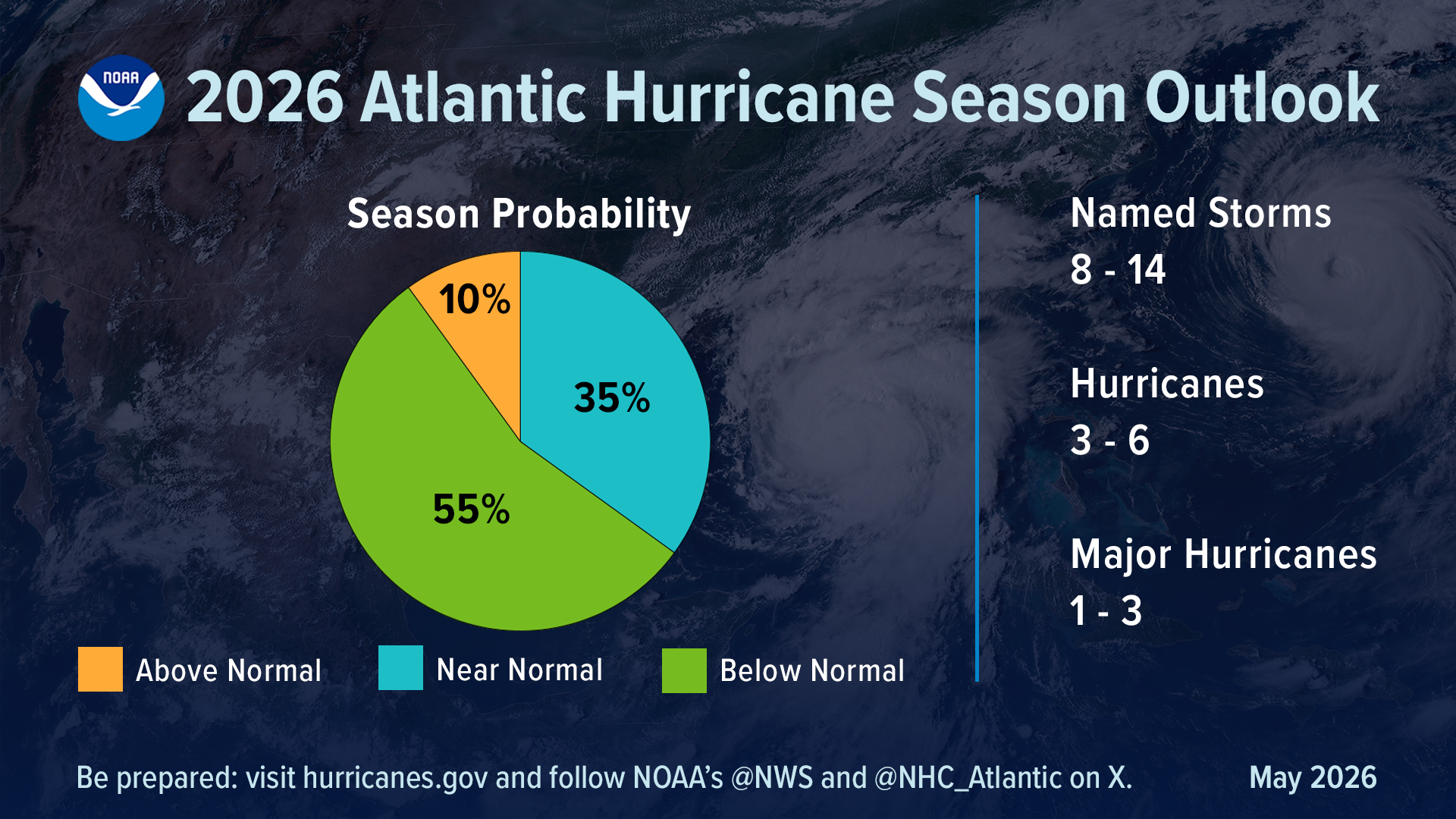
MILWAUKEE: While Wisconsin doesn’t get directly hits from tropical systems, the Atlantic hurican season can impact us here in the Great Lakes. Many times, the very wet remnants of systems pass over our area with soaking rain. The decaying storms can also bring strong wind and destructive downbursts. Additionally, Because Wisconsin is geographically safe from direct strikes, UW-Madison (via the Cooperative Institute for Meteorological Satellite Studies (CIMSS) and the National Weather Service in Sullivan) serves as a major national hub for hurricane research and satellite tracking. With that in mind, let’s take a look at the latest from NOAA.
Federal forecasters are calling for a quieter-than-average Atlantic hurricane season in 2026, though NOAA officials stress that preparation remains critical because “it only takes one storm” to create a major disaster.
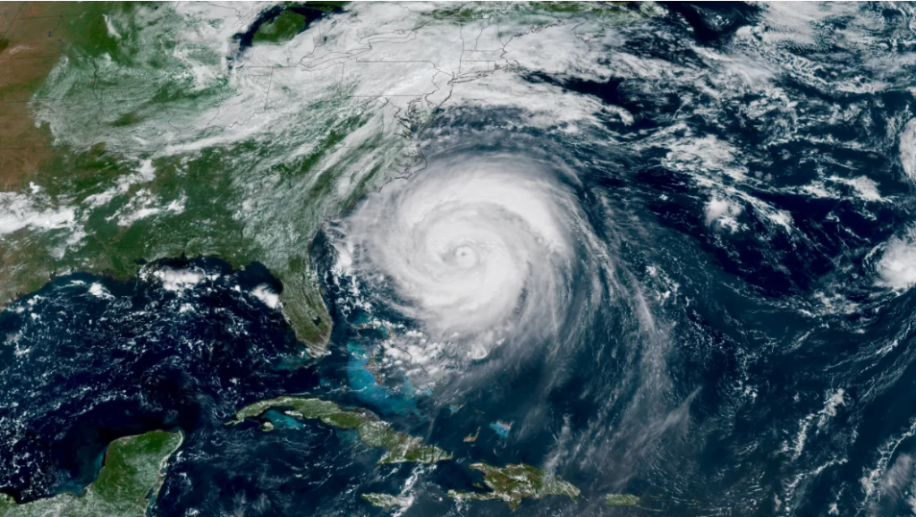
The National Oceanic and Atmospheric Administration released its annual Atlantic Hurricane Season Outlook on Thursday, forecasting a 55% chance of a below-normal season, a 35% chance of a near-normal season and just a 10% chance of an above-normal season. The Atlantic hurricane season officially runs from June 1 through Nov. 30.
What NOAA Is Forecasting
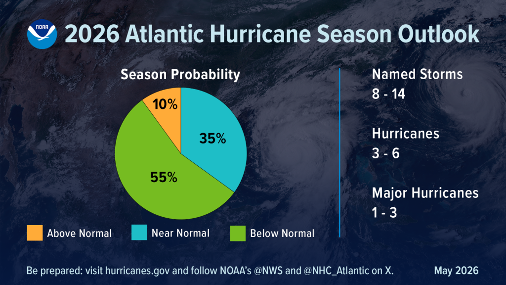
(Image credit: NOAA)
NOAA predicts:
- 8 to 14 named storms
- 3 to 6 hurricanes
- 1 to 3 major hurricanes
An average Atlantic season typically sees 14 named storms, seven hurricanes and three major hurricanes.
Forecasters say the expected development of El Niño during the summer and fall is one of the main reasons for the quieter outlook. El Niño tends to increase upper-level winds across the Atlantic Basin, making it harder for tropical systems to organize and strengthen.
At the same time, NOAA notes Atlantic waters are still expected to run warmer than average, which could partially offset some of El Niño’s suppressing effects.
“Although El Niño’s impact in the Atlantic Basin can often suppress hurricane development, there is still uncertainty in how each season will unfold,” said NOAA National Weather Service Director Ken Graham. “That is why it’s essential to review your hurricane preparedness plan now. It only takes one storm to make for a very bad season.” – NHC
NOAA Highlighting New Hurricane Forecast Technology
NOAA officials also highlighted several new forecasting and communication tools being rolled out for the 2026 season.
Among the upgrades:
- Improved hurricane cone graphics that now include inland tropical storm and hurricane watches and warnings
- Experimental forecast cones showing a broader range of possible storm tracks
- New storm surge products for Hawaii
- Expanded use of AI-based weather models
- Increased use of drones and uncrewed aircraft systems in hurricane forecasting
NOAA says early testing shows the addition of uncrewed aircraft data into hurricane forecast models may improve intensity forecast accuracy by as much as 10%.
Hurricane Preparedness Still Matters
Officials emphasized that seasonal outlooks are not landfall forecasts and do not predict where storms may strike.
Even in quieter seasons, damaging hurricanes can and do make landfall in the United States.
“Preparing now for hurricane season — and not waiting for a storm to threaten — is essential for staying ahead of any storm,” Graham said. – NOAA
The season outlook will be updated again in early August, just ahead of the climatological peak of hurricane season, which typically occurs from mid-September into October.
2026 Hurricane Names
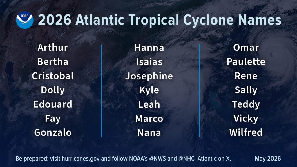
(Image credit: NOAA)
