

3 Things To Know:
- High temperatures are expected to be well above normal through Monday.
- Showers and thunderstorms may develop later Monday into Monday night.
- Cooler weather and more active conditions could return next weekend.
Today’s Weather Overview
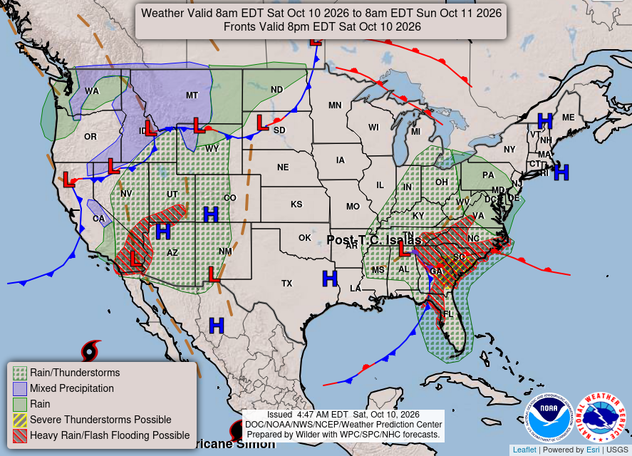
Early this morning, low pressure is moving into western North Dakota, bringing a warm front toward southern Wisconsin. Expect warm advection today, pushing most areas away from the immediate Lake Michigan shoreline to see temperatures climb to or above 80 degrees. The record high for Madison today is 84 degrees, established in 1938, but current forecasts anticipate a high just shy of that mark.
Southwesterly winds will be gusty due to a tight pressure gradient. While clouds from the remains of Hurricane Isaias will move northward into southeast Wisconsin, these may affect afternoon highs, depending on their timing. Overall, expect very warm temperatures today in the upper 70s to lower 80s.
Here’s a look at the WPC Day 1 forecast map:

Looking Ahead to Tomorrow
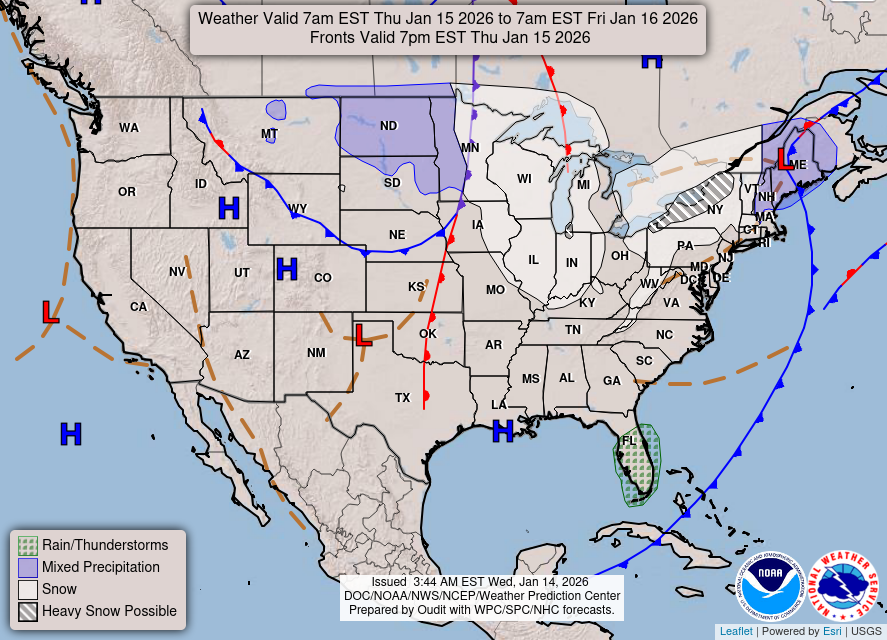
As we move into Sunday night and into Monday, the warm air will continue to push through the area. Highs on Monday could reach the lower 80s, approaching the record highs of 83 degrees at both Milwaukee and Madison. A cold front is expected to approach late Monday, likely bringing opportunities for showers and thunderstorms by evening or nighttime.
While the potential for severe storms remains uncertain, it is advisable to keep an eye on updated forecasts as we approach Monday. After the passage of the cold front on Tuesday, high pressure will bring a brief period of calm before we may see another round of active weather later in the week.
Here’s a look at the WPC Day 2 forecast map:
In summary, enjoy the warm weather this weekend and be prepared for potential storms as we head into Monday evening. Stay tuned for updates as conditions can change.
For updated forecasts where you live check out our Forecasts Page.
Source: NWS MKX Area Forecast Discussion, issued 2026-10-10T09:43:00+00:00.
