

3 Things To Know:
- Potential for showers and thunderstorms today, mostly north of I-94.
- Rain expected Thursday into Thursday night, with lower chances tomorrow.
- Significant drop in temperatures forecast for Friday night, leading to a potential killing freeze.
Monday’s Weather Overview
This afternoon, a shortwave moving across South Dakota will bring the possibility of showers and even a few thunderstorms to northern parts of Western Wisconsin, mainly north of I-94. The chance for rain this afternoon ranges from 15% to 45%. However, the overall instability in the atmosphere is expected to limit severe weather risks, with any thunderstorms likely to be elevated.
As the National Weather Service notes, “shear profiles through the column would be supportive of all forms of severe weather, but shear through the effective layer is far less supportive.” Thus, while some lightning and small hail could accompany these storms, major hazards are unlikely.
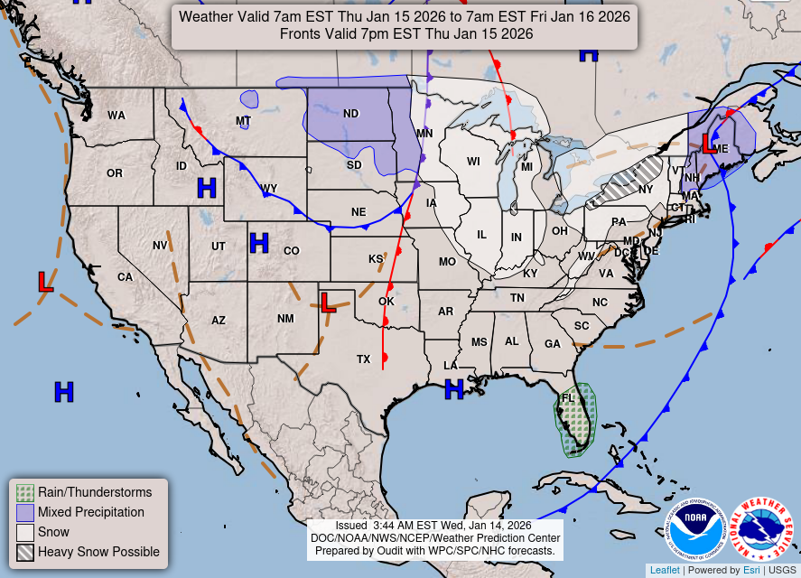
Below is the WPC Day 1 map, which outlines the weather conditions expected today.

Looking Ahead to Tuesday
Tuesday’s forecast shows a small chance (approximately 20%) for a shower in far southwest Wisconsin. However, the more significant weather event is expected Thursday and Thursday night, when a surface low will move northeast from the Texas Panhandle. Rain chances during this period are forecasted between 50% and 80% for areas across northeast Iowa and southwest Wisconsin. While there may be some fluctuation in timing, guidance suggests that temperatures will remain above freezing for the duration of this rain event.
Referencing future conditions, the National Weather Service indicates that “with our forecast area on the northwestern periphery of the surface low, final trajectory will be very important.” This means the exact path of the low will critically affect rainfall amounts.
Here’s the WPC Day 2 map to help you visualize potential conditions tomorrow.
Colder Temperatures Ahead
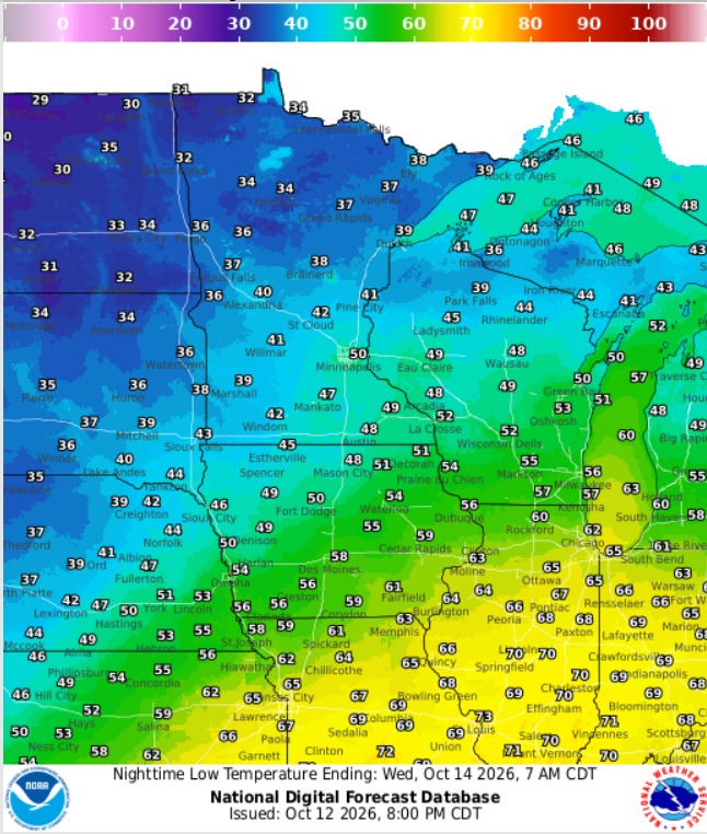
As we move into Friday night, it is essential to prepare for a significant drop in temperatures, particularly in areas north of I-94. The forecast indicates a potential for widespread frost and a chance (20-50%) for a killing freeze with temperatures possibly falling below 28°F. This marks a notable end to the growing season for many in that region.
Given the winds and clearing skies, it’s a good idea to protect any sensitive plants you may have before the cold sets in.
For updated forecasts where you live check out our Forecasts Page.
Source: NWS ARX Area Forecast Discussion, issued 2026-10-12T18:52:00+00:00.
