

3 Things To Know:
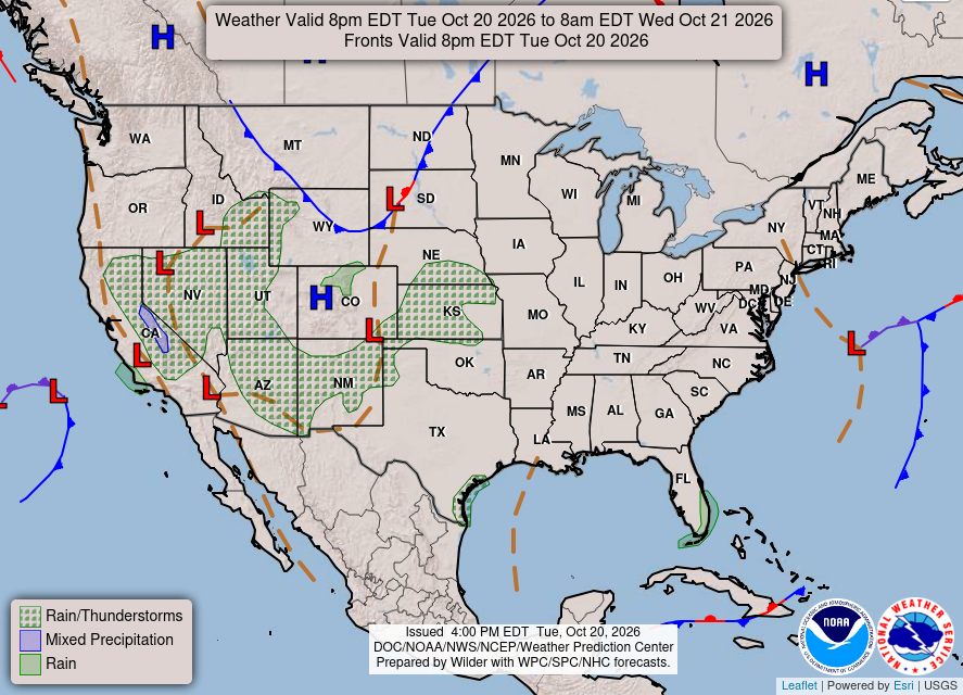
- Patchy dense fog is expected in eastern parts of the region tonight.
- Dry weather will continue with gradual warming through the weekend.
- Showers may return late Sunday into early next week.
Tonight’s Forecast and Fog Alert
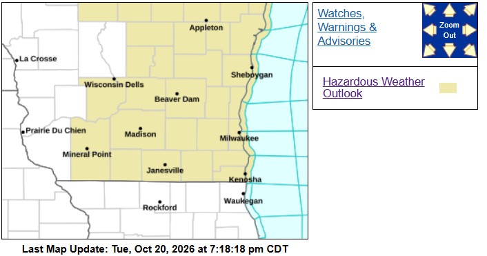
As high pressure shifts eastward tonight, patchy dense fog is likely to develop in eastern parts of Southeast Wisconsin. Residents near the shores of Lake Michigan should be aware that this fog may push onshore, impacting visibility into early Wednesday morning. The NWS has issued a Dense Fog Advisory for the nearshore waters north of North Point Lighthouse, which could affect outdoor activities and travel.
Temperatures tonight will dip into the mid to upper 40s, so make sure to dress accordingly if you’re heading out.

Looking Ahead: Warming Trend and Showers Possible
Moving beyond tonight, Southeast Wisconsin is set for a dry spell with seasonally warm temperatures ranging from the upper 60s to around 70 degrees through Friday. Being near Lake Michigan, expect slightly cooler temperatures.
As we look toward the weekend, warm south winds will prevail, but a cold front is expected to approach late Sunday. This may bring a 20 to 30 percent chance of showers and cooling temperatures as we head into early next week.
“Dry conditions are expected into the end of the week. Temperatures will remain above seasonal normal values.” – NWS Milwaukee/Sullivan
For updated forecasts where you live check out our Forecasts Page.
Source: NWS MKX Area Forecast Discussion, issued 2026-10-20T19:35:00+00:00.
