
A developing severe weather setup brings a tornado threat and large hail to central Wisconsin this evening as storms track along a warm front. Track storms live on our MAPS page.
3-Things To Know
- Tornado risk is increasing along a warm front from west-central into central Wisconsin this evening
- A 2–3 hour window exists for stronger, potentially tornadic storms before interference increases
- Large to very large hail is also a concern with the strongest storms
Tornado Threat Monday
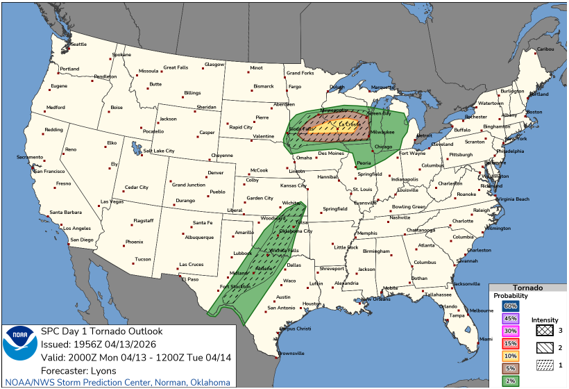
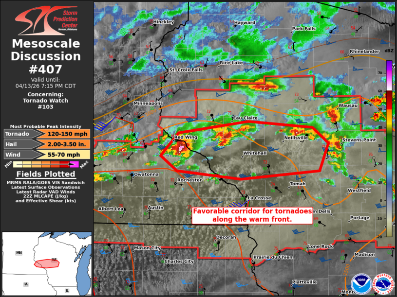
A volatile severe weather setup is unfolding across Wisconsin this evening, with the greatest concern focused along a warm front stretching from the Coulee Region into central parts of the state. According to the Storm Prediction Center, this boundary is creating a favorable corridor for tornado development over the next few hours.
“A favorable corridor for tornadoes will exist along the warm front.” – SPC
This setup is being driven by strengthening low-level winds and increasing wind shear, especially near the warm front where atmospheric conditions are most supportive of rotating storms. As those winds intensify early this evening, any storm that can remain isolated and track along the boundary will have the best chance to produce a tornado.
One storm already drawing attention in Minnesota, is being monitored closely as it tracks east. This storm has shown the potential to produce both tornadoes and large to very large hail in the near term, and it may serve as a preview of what could develop farther into Wisconsin.
The key uncertainty in this setup comes down to storm evolution. Early in the evening, discrete storms may have enough space to organize and intensify. However, as additional storms develop, interactions between them may limit the tornado threat later tonight.
“There will likely be a window during the next [few] hours where this is possible.” – SPC
That means the next several hours are critical for areas along and just north of the warm front, including parts of central Wisconsin. Residents should remain weather-aware, have multiple ways to receive warnings, and be prepared to act quickly if conditions deteriorate.
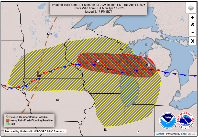
While tornadoes are the primary concern, hail up to or exceeding one inch in diameter is also possible, especially with the strongest storms that can tap into the unstable and sheared environment.
This is a classic early spring severe weather setup for Wisconsin, where the placement of a warm front can make all the difference between routine rain and a more dangerous evening.
For LIVE updates click our MAPS page.